Presentada por
Municipalité de Saint‑JulesDiscover the history of Saint-Jules by exploring its interactive map. Locate different points of interest and get on-demand information for each location. On a cell phone, the map allows you to take a self-guided tour of the site, including a GPS guide and a suggested itinerary for those who wish to live a unique experience and get off the beaten track.
NETWORK NOT REQUIRED ON SITE
For a better experience, we suggest that you download the BaladoDiscovery application on your cell phone (iOS / Android) and use the Preload option. You will then be guided and informed in the field without having to be connected to the Internet network during your travels.
CONTEXT
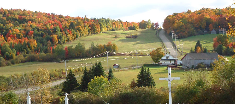
The origins of the municipality result from a request submitted to the Quebec diocese and by which the majority of franklings of the designated parties of St-Frédéric, St-Victor, St-Joseph and St-François parishes of the Beauce County asked that the said territory became a parish. Following this request, the canonical decree of the parish of Saint-Jules was established on November 5, 1918 by H.E. Cardinal Ls-N. Bégain, Archbishop of Quebec.
The municipality is fairly young - it will celebrate its hundredth anniversary in 2018. Since 2011, its population experiences a demographic growth, with 583 residents who are working had to maintain the rural character of a welcoming and friendly rural village unique to the Beauce area.
The municipality has unique features partly due to its constitution. It has several shared ranks, where one side is a public road located on Saint-Jules' territory, while on the opposite side properties are part of a neighboring municipality. Four companies offer telephone and Internet services.
Following the closure of the convent, the municipality has used it as City Hall, spaces for municipal organizations and a multipurpose center. In the same area is the Vaho Aventure aerial park, and the Camp les Étincelles, a social economy enterprise that animates the premises by welcoming groups of elementary school children and offering learning and leisure activities. Next to the church is a seasonal snack-bar, picnic tables behind the municipal building/Village aventuria and public restrooms in the municipal building.
Source: Book of Saint-Jules' 75th anniversary

Comentarios
Saint-Jules | MRC Beauce-Centre Heritage Tour